
Subdivision
Get a free estimate today!
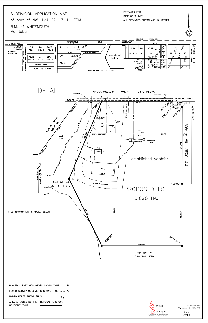

A subdivision of land is the process of taking a larger parcel of land and creating one or more smaller parcels from it. The process is the same for all subdivisions outside of Winnipeg, whether it is a one-lot or multi-lot subdivision. The first step is to contact the planning office for your area and determine what size and frontage will be allowed. The next step is to contact a Manitoba Land Surveyor who will prepare an S.A.M. (Subdivision Application Map) that is required as part of the application to subdivide. Here is the application form.
The surveying costs for a subdivision are directly related to the time that is required to complete the office work and field work. The preliminary office work includes obtaining a copy of the title or deed and is followed by searching through a wide variety of databases to compile the information that will be used to establish title boundaries. Part of this process will involve preparing a preliminary drawing that combines all of the compiled information. Preliminary field work is done to collect data used to produce the S.A.M. Once the planning office has approved the subdivision application the final fieldwork can be done and steel posts are placed to mark the property corners.
Although surveying equipment has changed since we started in 1970, the process of ensuring that the original boundaries are correctly defined before new boundaries are laid out remains the same. Existing monuments are located and checks are done to confirm that the monuments are in their original locations. If a post is missing, we make calculations to determine the most probable area of the original location and dig a large hole to search for evidence such as rust that might have come off the post before it was removed. The same technique is used if wood posts were used for the original survey. Wood posts were still being placed until 1950.
The final stage includes drafting of the final plan and submitting this to the land titles office for technical checking. If any of the utilities have indicated that an easement is required, we communicate with them to determine what their requirements will be. Once the land titles’ office completes their examination, the final plans are produced and then have to be signed by both owners of the land and the planning office before being submitted for registration. It is at this registration process where a plan number will be assigned and the new titles will be issued